Devon Walks - Hartland Quay
Looking ahead just a bit and thinking about this year’s stranger than normal Christmas, I’ve started thinking about the kind of walks I’d be doing during the festive period.
Maybe I’m in a minority here, but I like my Christmas festivities to be snug and cosy and traditional. I like log fires, comforting midwinter food and something mulled and tasty to drink. But everything in life should be about balance, which means that my outdoor activities are best done on the wild side.
Bring on the December gales or the snow and ice, I say. And let me walk in places where you get to see Nature at her most extreme.
Extremities don’t come more edgy than Hartland Point. It is the place where the soft shires of England seem to finally give way to the ravages of the Atlantic. Where the Anglo Saxon gives way to the Celtic. Where the West Country musters and hunches its massive shoulder to the wilderness of the waves.
Hartland Point is one of the region’s great corners. A glimpse at a map of the West Country will reveal it in a trice, for it is the northern apex of the peninsula’s vast triangle.
You approach the charming town of Hartland thinking you must be close to the famous Point, when a sign tells you that there are still five more long miles to go. And so you drive on, forever westward, until you see the breathtaking view from the car park at Hartland Point.
Well worth the entry price compared with some of the region’s other parking spots. From which other car park will you see seals frolicking and doing whatever seals do, from the comfort of your vehicle?
You can at Hartland, although a good pair of binoculars are advisable as the seals are a long, long way below.
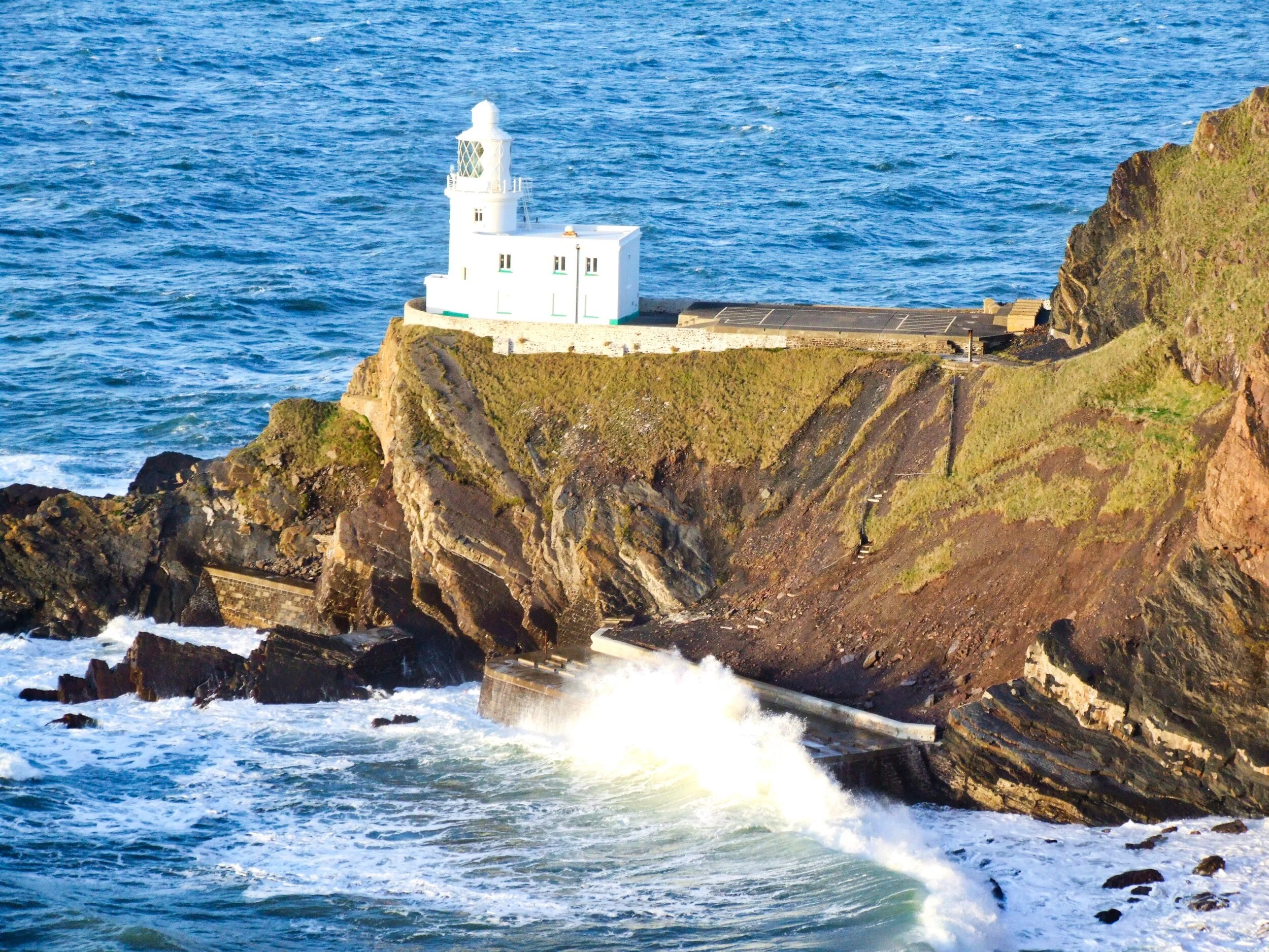
An interpretation board greets the walker heading off towards the Point, and the first thing you learn is that the narrow road down to the lighthouse is out of bounds to the public. You also learn that Hartland Point is further away from a railway station than any other place in Devon, and that it marks the beginning - or end - of the Bristol Channel.
Basically this walk follows the Coast Path south along Blagdon and then Upright Cliff, before crossing the deep valley to cut inland of the strange spur called Smoothlands. Then proceed around Blegberry to Blackpool Mill where a footpath climbs inland above Berryhill Wood to the lane at Markadon. Here a track sets off across the fields north to the farm at Blegberry where another lane leads east and then north down into the deep coombe so that it can join the bridleway that eventually climbs back up to Blagdon Farm, which is more-or-less where you began.
Sounds complicated but a glance at Ordnance Survey's Explorer Map 126 will clarify the route and show you just how simple it is.
We walked out to the Point and, rather dangerously - so we cannot recommend it to readers - scrambled out onto the high rocks above the lighthouse. Do not even think about this detour if you suffer the slightest twinge of vertigo.
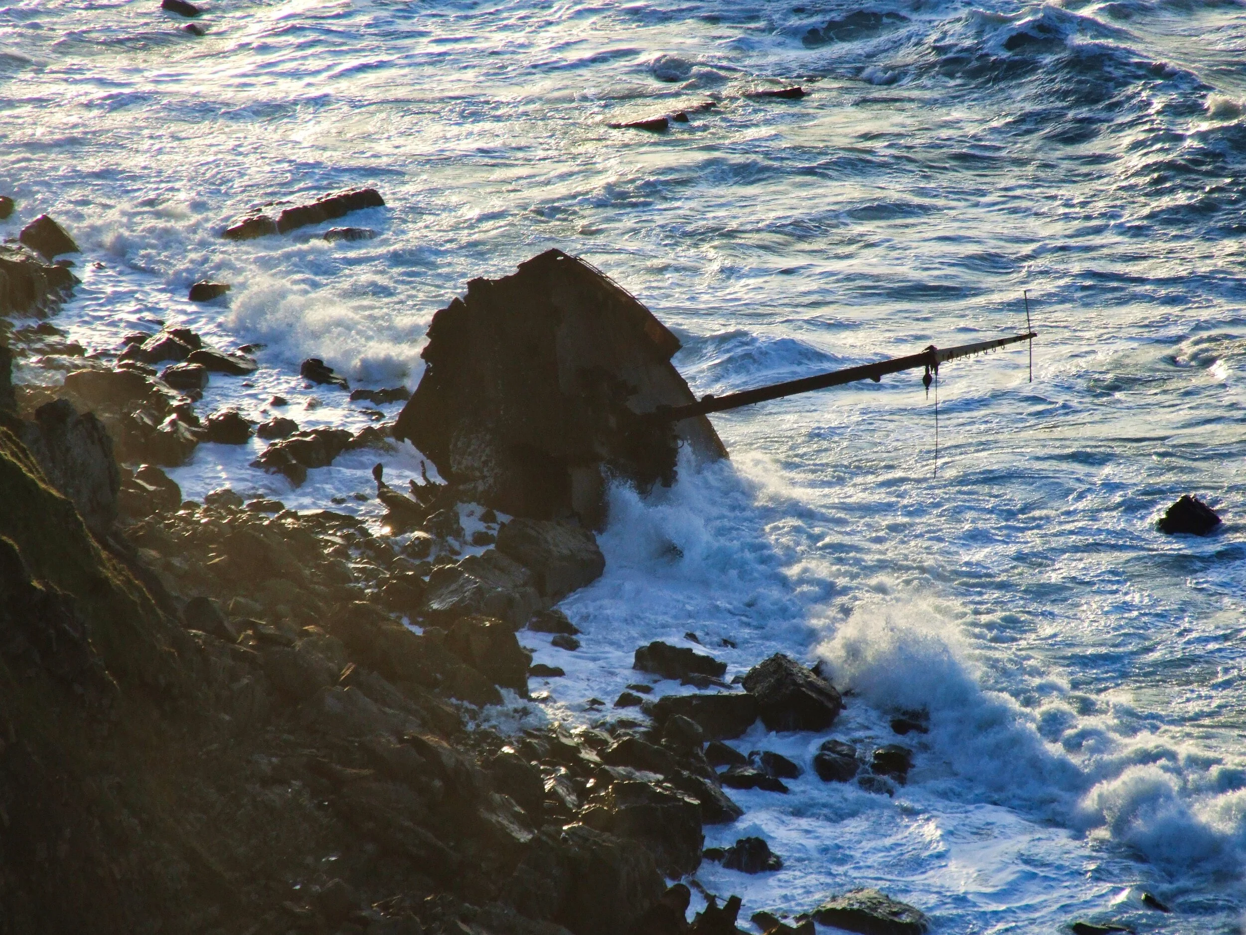
You’ll see the remains of a shipwreck in the region lying on its side just to the west of the Point. The entire stern section of the cargo ship Joanna is just underneath the cliffs and you can gaze down at the massive superstructure and wonder at the power of the waves that hurled this mighty thing to its destruction.
A quarter of a mile along the shore you will see the bow section, with a single mast pointing like a forlorn and accusative finger at the sea that did for it. The Joanna foundered here on 31st December 1982 within hailing distance of the lighthouse. As a New Year treat her crew got a helicopter ride on a chopper from Chivenor. The three officers were later taken off by the Clovelly lifeboat.
She was carrying wheat to Barry in South Wales when she came to grief, so you’d think they might call this Wheat Bay. I say that because the great sweeping bight east of Hartland Point is for some reason called Barley Bay.
It was around this that we then walked to National Trust owned land at East Titchberry. Here there's another impressive indentation in the cliff-lined coast, called Shipload Bay. Exactly which ship and which load, no one has been unable to establish: you can take your choice from hundreds of vessels wrecked in these parts.
Hartland Point
After all, Hartland Point was, for centuries, known as "The Sailors' Grave". The first documented wreck around here occurred in 1321 and since then the razor rocks, have been piling them high with regular monotony. Man himself was responsible for a good many of the sinkings: in the First World War this was a favourite hunting ground for German U-boats and between 1914 and 18 no fewer than 268 vessels were sunk by the Wolf Pack in the Bristol Channel - the majority in the vicinity of Hartland Point.
After walking the basic route described we headed back north wondering
what the giant 150-foot mushroom is doing perched on top of North Cliff. The folk flying large aeroplanes many thousands of feet above know more about this than walkers - it is part of the country's air-traffic-control network guiding the airliners in from the Atlantic.
The mushroom, and the old lighthouse hundreds of feet below, somehow underline the impression that you are very much on the edge of things out here on the very edge of a West Country consumed by Christmas.
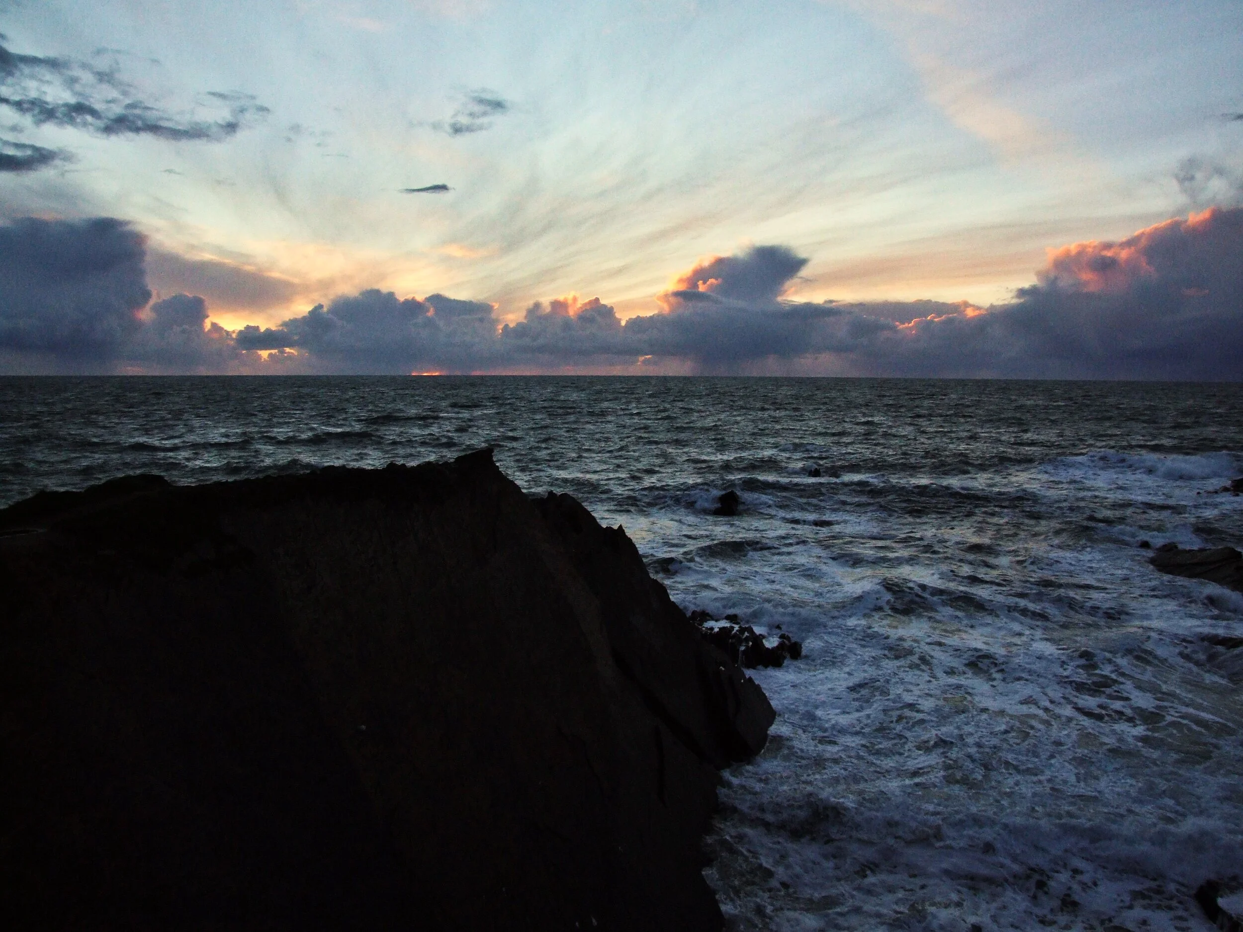
Hartland sunset
Fact File
Basic Hike: circular route from Hartland Point to Blackpool Mill and back via inland paths.
Recommended Map: Ordnance Survey Explorer 126.
Distance and going six miles.
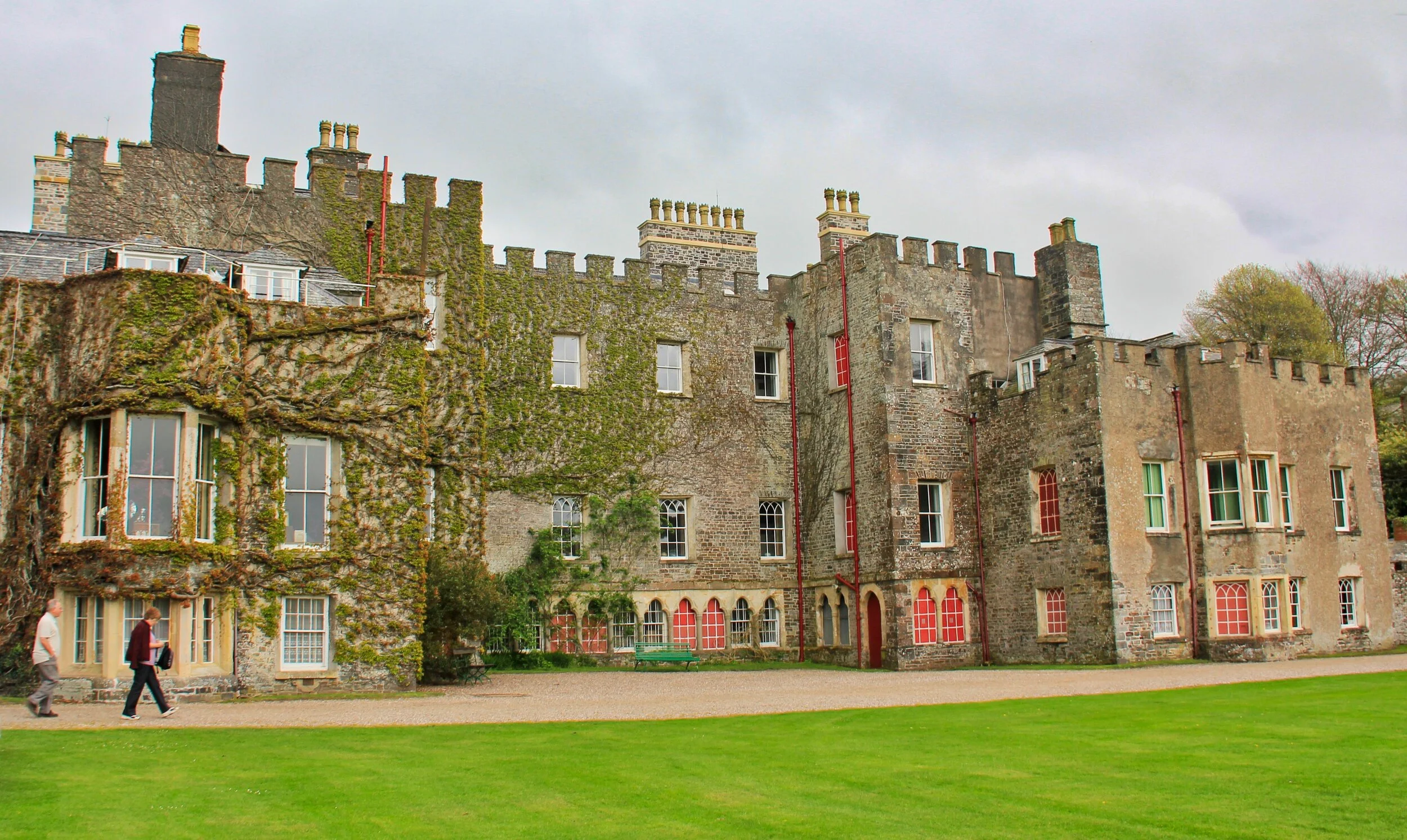
Hartland Abbey frontage
About the abbey
Much of the landscape we see in today’s walk belongs to the Stuckley family of Hartland Abbey. You must check the website (http://www.hartlandabbey.com) for opening times but I think it’s one of the most charming and interesting historic houses in the region.
Cue: pub at the quay
If wild is what you’re after today’s walk will supply it - and there’s even a watering hole located in one of the most exposed places in the entire region for lunch. Check out http://hartlandquayhotel.co.uk for info on the pub at Hartland Quay.
Jump for Johns
If a picnic is what you’d like to enjoy while walking on the wild side in North Devon, check at the amazing John’s delicatessen conveniently located at both Appledore and Instow (http://www.johnsofinstow.co.uk)
Shipwreck at Hartland Point


