Cornish Walks: Mullion to Lizard
When a friend invited me to join him on the coastal walk from Mullion Cove to the Lizard the other day, I wasn’t about to say no - even if the weather threatened. The west coast of the Lizard is no place to be in a storm - the entire look of the place is one that is carved from wind and spume - but it is very, very beautiful.
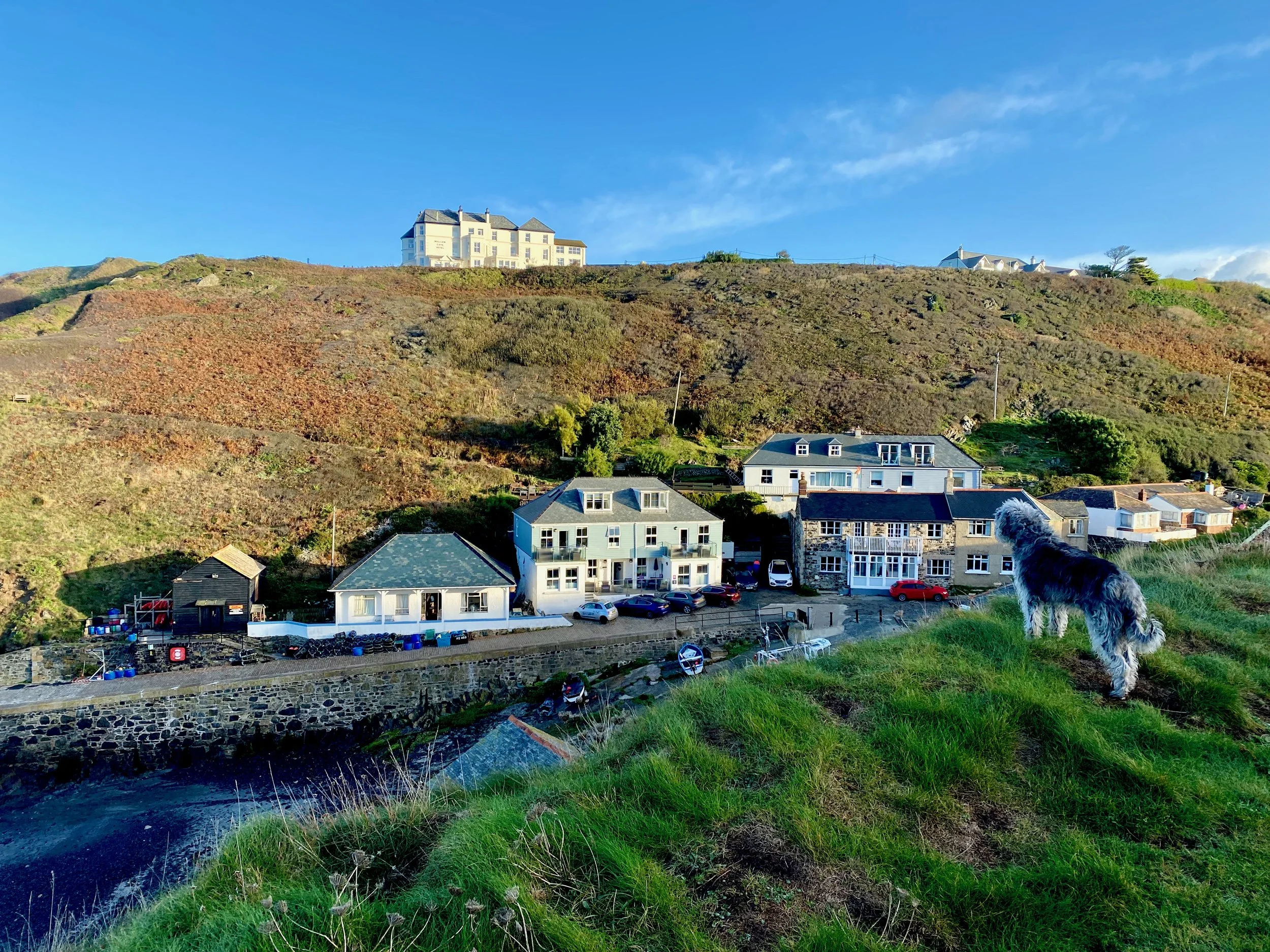
And, anyway, I was staying at the excellent dog-friendly Mullion Cove Harbour Apartments which is THE ideal base for a seaborne jaunt along the South West Coast Path.
The climb out of Mullion Cove is a steep one - but once you’re up on the high cliffs it’s all fairly level with a few ups and downs on the way - although nowhere near as big-dipper like as the coast path can be along its rugged length.
Along this first section of the hike you can look over your shoulder to the north and see how St Michaels’ Bay curves around in a mighty arc past Porthleven all the way to Penzance, Newlyn and Mousehole.
But once you are around the corner of Predannack Head you are in a wilder, more remote bit of coastal country.
Predannack is a far-flung place and its landscape is as outlandish as its distant location. It is a graveyard for the helicopters and aeroplanes which you can see in our photographs. You can see them in the distance on this walk.
Here’s a brief World War Two tale that refers to RAF Predannack. A Flying Fortress co-pilot wrote that he had been returning to England after a bombing mission when he and his crew were attacked by German FW-190's, and in the scrap they lost an engine and had two others damaged.
“We jettisoned over two tons of equipment and had dropped to 20 feet over the water when we were attacked by another two FW-190's. One was shot down by our gunner, and the other flew away. We landed our badly damaged B-17 at RAF Predannack.”
A harrowing tale, simply put. You will see the old aerodrome where Dave Rogan of the 358th managed to land that giant machine, and you may even feel a frisson of fear, thrill and danger just looking at the disused runway where larks now sing.
A quick look at the map will show you how the old airfield dominates the landscape up here. The walk continues along the clifftops past features with fantastic names - in one bay alone there's Gew-graze, Pigeon Ogo and Ogo Pons…
Past Vellan Head with its mighty cliffs we go before tucking in around the indentation where Soap Rock stands to reach the wide plain above Kynance Cliff. I say wide plain - but this entire landscape is nothing but a big wide plain once you’re inland from the cliffs.
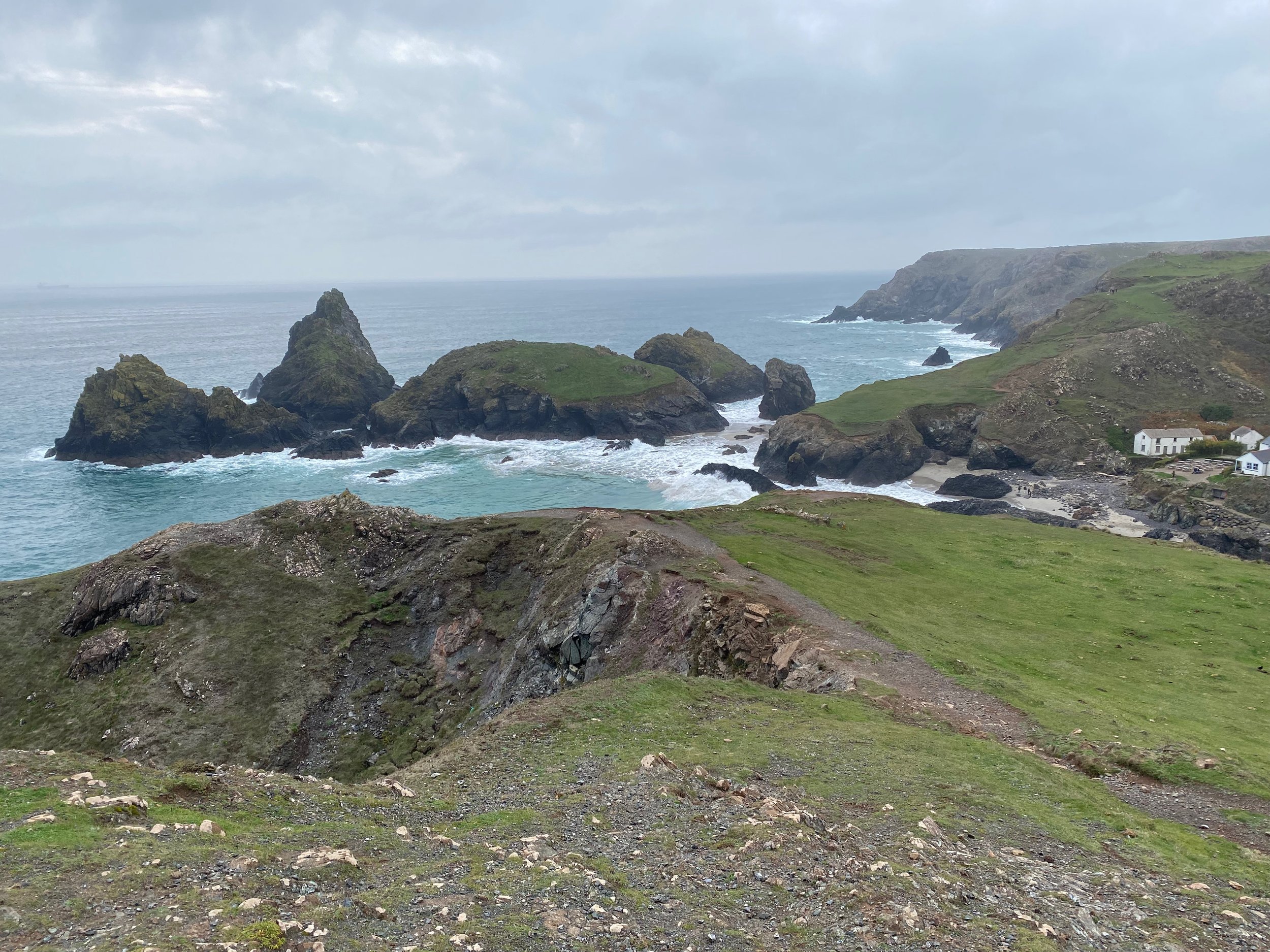
And before you know it you'll be down at Kynance Cove which is one of the great National Trust treasures to be found along our splendid shores. It is the most quintessential of coves and over the years I've been lucky enough to see it in all its moods: from soft sandy paddling pool to boiling raging cauldron.
I do not know why the cafe here closes in winter - I’d have thought the National Trust would be pleased to keep the place open given all the folk who wonder down to the cove even at this time of year. An old place this - there was a cafe at Kynance Cove as early as 1700. Excursionists - as tourists were once called - used to come here to marvel at nature's cauldron. Alfred Lord Tennyson was so impressed he visited twice to admire the "glorious grass green monsters of waves."
We looked down past Asparagus Island into Rill Cove where, in 1616, a galleon of some sort was wrecked. No one knows what ship this was but divers have brought up a banded breechloading gun and more than 300 16th Century coins from its tide based skeleton.
Stunning coastal panoramas. That sums up this entire walk in a far-flung seashell and if you like dizzying cliffs and the roaring crash of the wildest of seas, then this is the place for you.
And so we went, past the National Trust car park on our way to the British mainland’s most southerly point. Past past Pentreath Beach, Caerthillian Cove, Holseer Cove, and Venton Hill Point we went to eventually reach Lizard Point itself. Some call it Old Lizard Head, while the one just below the car park beyond is Lizard Point proper.
Around the corner we come to Pistol Meadow. Nothing to do with firearms - the name comes from the Cornish 'pystyll' meaning waterfall. I say the place is sepulchral because some 200 bodies are buried there and you can still make out low mounds of graves inland from the grove of tamarisk trees.
In 1720 a troop ship called the Royal Anne ploughed into the rocks of the bay - you only have to look at the reefs to know that few survived. No Christian burial, just a mass-grave beyond the tamarisk. Some say you can still hear the cries of lost souls on a stormy night, or is it only the distant clanging of the shipping buoy?
At last we reach our destination - or Lizard Point proper, to put it another way. We had lunch here at the little cafe just before the heavens opened. My wife had arrived to pick us up - otherwise it was either a seven mile walk back or a hike up to Lizard Town where we could have caught the No 37 bus back to Mullion.
Which ever way you make your return, you will have enjoyed one of the best coastal walks in England - and certainly, the most southerly coastal walk in the mainland UK.


